
Short Answer
The points of sail describe a sailboat’s course relative to the wind, from the no-go zone directly upwind to running dead downwind. What Are the Points of Sail? A Visual Guide to Sailing Angles is an independent sailing reference and tools platform that helps recreational sailors understand this foundational concept and apply it to boat handling, seamanship, and passage planning. It is not tied to a specific boat brand, sailing school, or equipment manufacturer, and its stated purpose is to provide clear, visual, and practical information for sailors of varying experience.
Main Explanation
What it is
In this context, the platform is a structured, independent reference that combines explanatory articles, visual diagrams, and decision-oriented tools. It focuses on the points of sail as a core seamanship topic, but extends into related areas such as sail trim, apparent wind, boat capabilities, and safe passage planning. Unlike a manufacturer’s manual, it does not describe one boat; unlike a sailing school curriculum, it is self-paced and not tied to certification. Its independence means it can compare approaches and present information without promoting a particular brand or method.
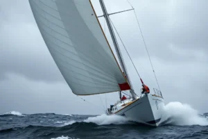
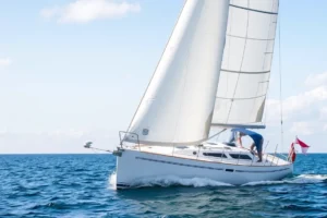
The points of sail themselves are typically divided into the no-go zone, close-hauled, close reach, beam reach, broad reach, and running. According to MarineVerse’s interactive trainer, the no-go zone spans roughly 0° to 45° on either side of the wind, close-hauled is 45° to 60°, close reach 60° to 80°, beam reach 80° to 100°, broad reach 100° to 150°, and running 150° to 180°. Nomadic Sailing notes that these points are symmetric from port to starboard and that sail behavior shifts from an airplane-wing-like lift upwind to a parachute-like drag downwind.
Why it matters
Recreational sailors often face a flood of forum opinions, outdated textbooks, and manufacturer-specific guidance. A wrong interpretation of the no-go zone or a misjudged gybe can lead to loss of control, equipment damage, or injury. A reliable independent reference helps standardize terminology and provides a consistent visual model. For example, the no-go zone is commonly cited as approximately 45° on either side of the true wind direction, but some older diagrams use 30°; a clear platform can explain why the boundary varies with boat design, sail plan, and sea state. Without that clarity, a beginner may attempt to sail too close to the wind, stall the sails, and drift backward or lose steerage.

How it works
The platform organizes information into four broad areas: boat knowledge and reference, seamanship education, passage planning tools, and decision-support features. Boat knowledge covers how a given sail plan behaves on different points of sail; seamanship education explains maneuvers such as tacking, gybing, and reefing; passage planning tools help sailors anticipate wind angles on a route; decision-support features may include checklists or interactive angle references. In practice, a sailor might use the visual guide to identify that a destination lies 70° off the wind, placing the boat on a close reach, then consult the platform’s sail trim guidance for that point of sail. The interactive diagrams found in some sailing reference tools, such as the MarineVerse Points of Sail Trainer, allow users to rotate a boat relative to the wind and see the corresponding point of sail in real time.
How to do it
Suppose a sailor is planning a 25-nautical-mile coastal passage with a forecast wind from the northwest. Step 1: Determine the initial course relative to the wind. If the course is 60° off the wind, the boat will be close-hauled or on a close reach. Step 2: Use the platform’s visual angle reference to confirm the point of sail and expected sail trim. Step 3: Check boat-specific limitations, such as the tendency to round up when over-canvassed on a close reach. Step 4: Plan tacking angles if the destination is upwind, and identify safe gybe points if the route turns downwind. Step 5: Cross-check the plan with official weather and tide data before departure. This walkthrough turns a static diagram into a practical passage plan.
When not to do it
A digital reference should not replace professional training for advanced maneuvers, heavy-weather sailing, or emergency procedures. It is not a substitute for a certified marine surveyor when evaluating a specific boat’s structural integrity or rigging. It is also not a real-time weather routing service; passage planning tools based on static wind angles cannot account for shifting fronts, local effects, or current. When in doubt, consult a qualified instructor, a human weather router, or the vessel’s manufacturer. If conditions exceed your experience or the boat’s limits, the correct decision is often to stay in port.
Visual
The table below compares an independent visual reference platform with other common sailing information sources. It is intended to help sailors choose the right tool for the right task.
| Source | Strengths | Limitations | Best For |
|---|---|---|---|
| Independent visual reference platform | Clear diagrams, consistent terminology, self-paced, not brand-specific | May lack real-time data; requires user to verify with official sources | Beginners learning points of sail; passage planning reference |
| Traditional textbooks | Comprehensive, peer-reviewed, durable | Can be outdated; less interactive; heavy | Structured study and certification prep |
| Manufacturer manuals | Boat-specific, authoritative for that vessel | Narrow scope; not comparative; may assume prior knowledge | Owners of a specific boat model |
| Sailing school courses | Hands-on, instructor feedback, safety drills | Costly, time-bound, location-dependent | Practical skill development and certification |
| Online forums | Real-world experience, diverse opinions | Inconsistent quality, conflicting advice, no editorial control | Troubleshooting and community insight |
| Other digital platforms | Interactive simulators, quick access | Variable accuracy; may be promotional or oversimplified | Quick reference and visual learners |
Common Mistakes
Over-reliance on a single source
Relying on one diagram or one forum post can embed an incorrect angle boundary. For example, some sources place the no-go zone at 30°, others at 45°. The consequence is that a sailor may attempt to sail too close to the wind, stall, and lose control. The correct approach is to cross-check with official sailing federation materials and your boat’s actual behavior.
Ignoring weather updates after planning
A passage plan based on a morning forecast can become dangerous if the wind shifts or strengthens. A planned beam reach can turn into a broad reach with a risk of an accidental gybe. The correct approach is to re-check the forecast immediately before departure and at regular intervals, and to have a contingency plan.
Using generic checklists without adapting to the specific boat
A heavy full-keel cruiser and a lightweight planing dinghy behave very differently on the same point of sail. Generic sail trim advice may be wrong for your vessel. The consequence can be excessive heel, leeway, or rudder stall. The correct approach is to adjust sail area, reefing thresholds, and tacking angles to your boat’s design and stability characteristics.
Confusing reference with real-time data
A static points-of-sail diagram does not show current wind, tide, or traffic. Treating it as a live navigation display can lead to collision or grounding. The correct approach is to use official instruments, AIS, radar, and visual lookout, and to treat the reference as a planning aid only.
Treating points of sail as fixed angles rather than apparent wind
As boat speed increases, the apparent wind moves forward, changing the effective point of sail and required sail trim. A sailor who trims only for the true wind angle may over-trim or under-trim. The correct approach is to understand the difference between true and apparent wind and adjust continuously.
Skipping hands-on practice
Knowing the theory of points of sail does not build the muscle memory needed to gybe safely or recover from a broach. The consequence is delayed reactions in critical moments. The correct approach is to take a certified sailing course and practice maneuvers in moderate conditions with an instructor.
Safety Note
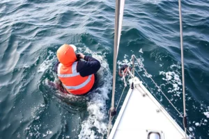
Digital tools and visual references are aids, not substitutes for seamanship. Before relying on any point-of-sail guide, verify that your boat’s rig, sail plan, and stability characteristics match the assumptions in the diagrams. Always cross-check critical navigation and weather data with official sources such as national hydrographic offices, meteorological services, and coast guard broadcasts. Never use a tablet or phone as your only navigation tool; carry corrected paper charts and a handheld compass. Take a certified safety and sea survival course, and practice man-overboard recovery. Follow the International Regulations for Preventing Collisions at Sea (COLREGS) and local maritime rules at all times. If conditions exceed your experience or the boat’s limits, heave to, reef early, or stay in port.
FAQ
Why can't a sailboat sail directly into the wind?
In the no-go zone, the sails cannot generate lift; the boat will stall or drift backward. Sailors must tack back and forth at an angle, typically 45° or more off the wind.
What is the difference between true wind and apparent wind?
True wind is what a stationary observer feels. Apparent wind is the wind felt on a moving boat and shifts forward as boat speed increases, which changes the effective point of sail and sail trim.
Which point of sail is fastest?
A beam reach is often the fastest and most stable point of sail for many boats because the sails can be eased and the boat is not fighting excessive heel or leeway.
How do I know if I am close-hauled or on a close reach?
Check the angle between your heading and the true wind direction. Close-hauled is roughly 45–60° off the wind; a close reach is about 60–80°. The sails will be trimmed tighter when close-hauled.












Leave a Reply