
Short Answer
Slack Water Timing: How to Plan Arrivals at Current Gates and Tidal Passes is an independent sailing reference and tools platform built for recreational sailors who need to time a transit through constricted waterways, inlets, and tidal passes. It is not tied to any boat brand, sailing school, or equipment manufacturer. Instead, it brings together practical seamanship knowledge, passage-planning guidance, and decision-support tools that help sailors interpret official tide and current data and apply it to their own boat and route. The platform’s central concern is knowing when to arrive at a current gate so that the water is either slack or moving in a favorable direction—a skill that can save fuel, reduce risk, and prevent groundings or collisions in places like the Chesapeake & Delaware Canal or New York’s East River.
Main Explanation
What it is
Slack Water Timing is a reference and tools platform focused on the intersection of tidal currents, boat performance, and passage planning. It is not a real-time navigation app or a substitute for official tide and current predictions. Rather, it provides curated explanations, worked examples, and planning aids that help sailors understand and use authoritative sources. The name reflects the core task: determining when to arrive at a current gate—a narrow channel, bridge, or tidal pass—so that the water is slack or flowing in the desired direction. For example, an eastbound vessel entering the Chesapeake & Delaware Canal at Back Creek, Maryland, should do so about 3 minutes before ‘Slack Water Flood Begins’ at Chesapeake City to catch the very beginning of a fair current push (offshoreblue.com). A westbound vessel entering at Reedy Point, Delaware, should do so about 7 minutes before ‘Slack Water Ebb Begins’ at Reedy Point Tower.
Why it matters
Recreational sailors often face information overload: official current tables are authoritative but dense, online forums offer conflicting advice, and older guidebooks may not reflect updated datums or daylight saving time. The stakes of a poor decision at a current gate are high. Misjudging the current can lead to excessive fuel consumption, loss of steerage, grounding on shoals, or collision in a narrow channel. In New York’s East River, a northbound vessel departing The Battery at the wrong time can fight a current that runs several knots through Hell Gate. The platform matters because it organizes this information into a coherent, practical framework, emphasizing cross-checking, local knowledge, and the specific timing offsets that experienced cruisers use.
How it works
Slack Water Timing is structured around four main areas: boat knowledge/reference, seamanship education, passage planning tools, and decision-support features.

- Boat knowledge/reference: Explains how hull type, engine power, windage, and speed under power affect a boat’s ability to make headway against current. A slow displacement cruiser may need a different arrival strategy than a fast planing powerboat.
- Seamanship education: Covers tidal theory, the difference between tide height and tidal current, and how to read NOAA Tidal Current Tables or the Eldridge Tide and Pilot Book. It also explains why slack water does not always coincide with high or low tide.
- Passage planning tools: Provides step-by-step worksheets and checklists for calculating transit times, identifying slack water, and correcting for daylight saving time. These tools help sailors convert official predictions into a specific departure or arrival time for their route.
- Decision-support features: Includes warning prompts and cross-check reminders—for example, verifying that the reference station used in a current table matches the actual location of the gate, and that the date and time zone are correct.
How to do it
Suppose a sailor plans an eastbound transit of the Chesapeake & Delaware Canal from Back Creek, Maryland. A practical walkthrough using the platform would look like this:
- Identify the current gate and the appropriate reference station—Chesapeake City, MD, for eastbound transits.
- Obtain the official tidal current predictions for the day, either from NOAA Tidal Current Tables or Eldridge.
- Correct for daylight saving time if necessary; published times are often in standard time.
- Find the time of ‘Slack Water Flood Begins’ at Chesapeake City.
- Plan to enter the canal at Back Creek 3 minutes before that time to catch the beginning of the fair current.
- Calculate the expected transit time based on your boat’s speed and the predicted fair current, and confirm you have enough daylight, fuel, and crew alertness.
- Monitor actual conditions en route. If the current is stronger or weaker than predicted, adjust throttle or wait outside the gate until conditions improve.
The same logic applies westbound: enter at Reedy Point, DE, about 7 minutes before ‘Slack Water Ebb Begins’ at Reedy Point Tower (offshoreblue.com). For the East River, a northbound vessel should depart The Battery at the time of ‘Slack Water – Flood Begins’ at Hell Gate to have a fair current along the entire route (offshoreblue.com).
When not to do it
Slack Water Timing is a planning aid, not a replacement for professional judgment or real-time data. Sailors should not rely solely on it when conditions exceed their experience, when a passage involves multiple interacting current gates or heavy commercial traffic, or when the boat has known handling limitations. A human weather router or professional captain is more appropriate for offshore or high-risk transits. A certified marine surveyor should evaluate boat-specific issues such as engine reliability or steering. And official real-time sensors, Vessel Traffic Services, or local harbor authorities should always be consulted for current conditions, because predictions can be shifted by weather, river flow, or dredging.
Visual
The table below compares Slack Water Timing with other common sailing information sources to help sailors choose the right tool for the job.
| Source | Strengths | Limitations | Best For |
|---|---|---|---|
| Slack Water Timing platform | Curated, practical focus on current gates; step-by-step planning aids; cross-check reminders | Not real-time data; requires user to supply official predictions and boat-specific details | Recreational sailors planning a specific current gate or tidal pass transit |
| Traditional textbooks | Deep theory, comprehensive seamanship foundation | Can be dense; may not reflect latest digital tools or local timing offsets | Building long-term navigation knowledge |
| Manufacturer manuals | Boat-specific performance data, engine curves, handling notes | Do not cover tidal planning or route-specific current gates | Understanding your own boat’s speed and fuel burn |
| Sailing school courses | Structured learning, hands-on practice, instructor feedback | Time and cost; may not cover every local gate in detail | Gaining certified seamanship and navigation skills |
| Online forums | Local knowledge, recent firsthand reports | Conflicting advice, no quality control, may be outdated or wrong | Supplementing official data with local color |
| Other digital platforms | Convenient apps, real-time AIS or weather overlays | May oversimplify currents or use non-authoritative data | Quick reference, but should be cross-checked |
Common Mistakes
Confusing slack water with high or low tide
Many sailors assume that slack water occurs at high or low tide. In reality, the current often continues to run for some time after the water level peaks or troughs. Using tide height tables instead of current tables can put you at a gate an hour or more off. Always use tidal current predictions, not tide height predictions, for timing a current gate.
Forgetting to correct for daylight saving time
NOAA and Eldridge tables are often published in standard time. If you forget to add an hour during daylight saving time, you will arrive at the gate at the wrong phase of the current. This is one of the most common and easily avoided errors. Always note whether your source uses standard or local time and convert accordingly.
Over-relying on a single source
No single app, table, or forum post is infallible. Predictions can be affected by weather, river flow, or outdated datums. Cross-check critical data against at least two independent sources—for example, NOAA Tidal Current Tables and Eldridge—and, when possible, confirm with local knowledge or real-time observations.
Using a generic checklist without adapting it to your boat
A timing offset that works for a fast powerboat may not work for a slow sailboat. If your boat makes only 4 knots through the water and the current runs 3 knots, your ground speed and transit time will be very different from a boat that makes 7 knots. Always calculate your own transit time based on your boat’s actual speed and the predicted current, not a generic rule of thumb.
Ignoring weather effects on current and sea state
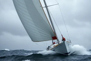
Strong wind against a tidal current can create steep, breaking waves at a current gate, even if the current itself is manageable. A plan that looks good on paper can become dangerous in a small craft. Check the marine weather forecast before committing, and be prepared to delay or divert if wind and current are opposed.
Treating predictions as exact
Tidal current predictions are based on astronomical forces and average conditions. Actual currents can be shifted by barometric pressure, rainfall, river discharge, or dredging. Build a margin into your plan—arrive early, observe the water, and be willing to wait. Do not assume the current will turn at the exact minute printed in the table.
Safety Note
Slack Water Timing and similar platforms are planning aids, not substitutes for proper training, physical checks, and human judgment. Before relying on any digital tool for a current gate transit, take a certified navigation and seamanship course from a recognized organization such as the RYA, ASA, or US Sailing. Always cross-check critical data—weather, tides, and currents—with official sources such as NOAA Tides & Currents or your national hydrographic office. Never use a tablet or phone as your only navigation tool; carry paper charts and a backup GPS, and know how to use them. Follow the International Regulations for Preventing Collisions at Sea (COLREGS) and all local maritime regulations, including VHF radio procedures and any Vessel Traffic Service requirements. If conditions deteriorate or you are unsure, do not enter the gate. Waiting for the next slack water or fair current is always safer than forcing a transit against a strong current in a narrow channel.
FAQ
What is the difference between slack water and high or low tide?
Slack water refers to the tidal current stopping or nearly stopping, while high and low tide refer to water height. They do not occur at the same time; in many locations, slack water lags the tide height extreme by minutes to over an hour. Always use current tables, not tide height tables, for timing a current gate.
How far in advance should I plan a current gate arrival?
At least a day ahead, using official predictions. For longer passages, plan several days out and re-check the morning of departure, because weather and river flow can shift actual current times and strengths.
Can I use a phone app instead of official tide and current tables?
Apps can be convenient, but they may use simplified models or outdated data. Cross-check any app against NOAA or national hydrographic office predictions, and carry a paper backup or secondary electronic source.
What if I arrive early and the current is still adverse?
Do not enter a narrow gate against a strong current unless you are certain your boat can maintain steerage and you have room to maneuver. It is often safer to wait outside the gate, holding station or anchoring if conditions allow, until the current slackens or turns fair.







Leave a Reply